
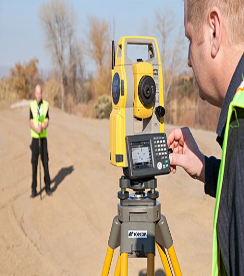
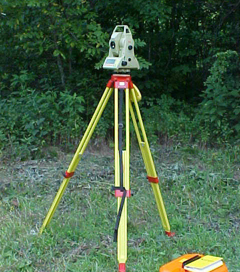
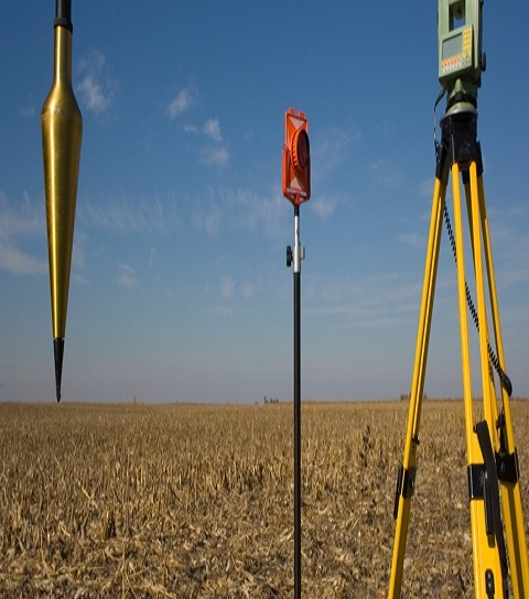
Total station is a surveying equipment combination of Electromagnetic Distance Measuring Instrument and electronic theodolite. It is also integrated with microprocessor, electronic data collector and storage system. The instrument can be used to measure horizontal and vertical angles as well as sloping distance of object to the instrument.
The technique widely known as land surveying has been in use for centuries and is known as the second oldest profession humanity has ever conceived. Because humans always had the need to know exactly where they were located and accurately determine their position in the planet, surveying was created back in ancient Egypt with the use of rope extensions and the applications of uncompounded geometry. Since those times, many things have evolved making tools and other accessories easier to use and to find accurate data, specially in the always important field of land surveying.
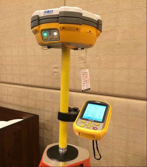
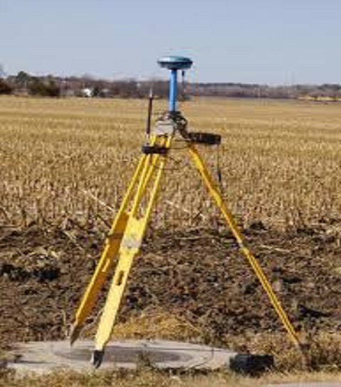
The DGPS (Differential Geographic Positioning System) Survey:
These are surveys which are carried out using the differential GPS. It achieves higher positional accuracy by making use of the differential capabilities
of two GPS antenna linked by a radio signal.
The DGPS Survey main features are:
Position is determined by distance from at least 4 satellites
Time taken by signal to travel from satellite to antenna used to determine the distance.
The base station
calculates the difference between the specified coordinates of its location and those indicated by the satellites.
The base is continuously broadcasting a signal to the rover of this difference.
The rover
then uses this same difference to accurately determine it’s location.
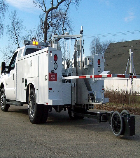
A falling weight deflectometer (FWD) is a testing device used by civil engineers to evaluate the physical properties of pavement. FWD data is primarily used to estimate pavement structural capacity for 1) overlay design and 2) to determine if a pavement is being overloaded. Use includes (but is not limited to) highways, local roads, airport pavements, harbor areas and railway tracks. The machine is usually contained within a trailer that can be towed to a location by another vehicle. It can also be built on a pickup truck or inside a mini van. There are also comprehensive units where a FWD device is mounted on a heavy truck together with a GPR cart and a TMA protection to have a complete road survey vehicle.
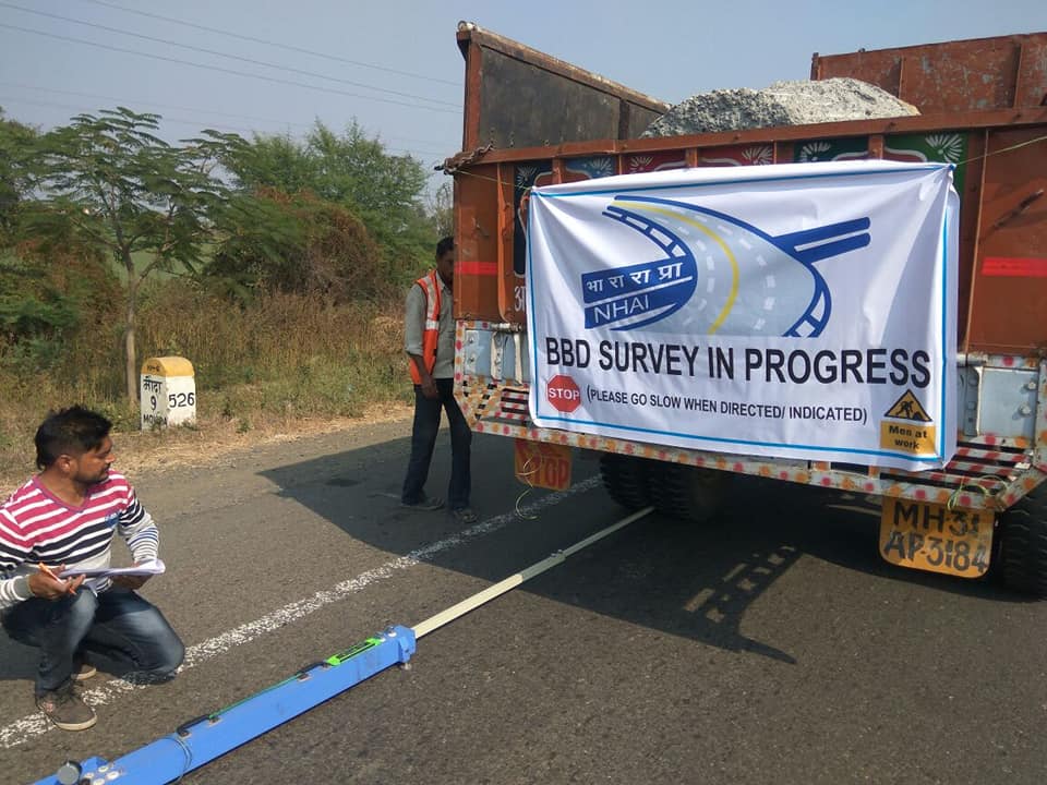
A brief note on BBD Survey: BBD and Bump IntegratorThis method of test covers a procedure for determination rebound deflection of pavement under static load on the rear axle of the standard truck. The dual wheels of the truck are centred about the point to be tested. The probe is then inserted between the duals and places on the point. The dial gauge is set 1cm and the initial reading is recorded when the deformation is equal to or less than 0.025mm per minute. The truck is then slowly driven for a distance of 270cm and then stopped. The intermediate reading is recorded when the rate of the recovery of the pavement is equal to or less than 0.025mm per minute. Then the truck is further moved forward to 9m. The final reading is recorded when the recovery rate of the pavement is equal to or less than 0.025mm per minute. During the survey the pavement and atmospheric temperatures are recorded at frequent intervals. Soil samples are also collected and tested in the lab for moisture content and plasticity Index. All these data are then processed to get the characteristic deflections. IRC-81 is extensively used to determine the calculation parameters. Corrections for moisture and temperature are applied to get the final results. These results further guide in the design of the overlay thickness.
© 2019 Narendra Geotechnical. All rights reserved
Our services are extremely applauded in the market due to timely completion and consistency. These services are rendered employing the advanced techniques. Owing to high demand, we render our services at nominal costs.